Hydrographical surveys map seafloor contours (and in some cases, shallow sub-sediment structures), and are carried out during site inspections for a number of pre- or post-construction activities. These include, but are not limited to: bridge, harbour, windfarm, and production platform construction; pre-jack-up drilling-rig positioning; estuary, river, port, marina and dock, marine-habitat mapping; archaeological and military surveys; pre and post-dredging; pipeline and cable inspections; and shipping lane surveys.
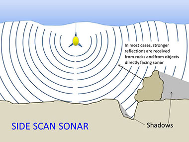
Schematic representation of seafloor mapping through hydrographic survey. Source: NOAA.
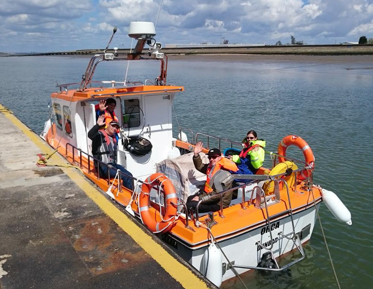
Hydrographical survey vessels can range from small inshore boats, like OSC’s MV Orca, to large, ocean-going vessels.
Schematic representation of seafloor mapping through hydrographic survey. Source: NOAA.
Do I need to consider Marine mammals for my hydrographic survey?
If your survey is emitting loud sounds at frequencies that could impact marine mammals, it is usual to assess the potential effects. OSC has provided a series of free tools to assist in this decision-making process and written a book on the topic, the Marine Mammal Observer and Passive Acoustic Monitoring Handbook (Todd et al., 2015).
Increasingly worldwide, Marine Mammal Observers (MMOs) are being used during hydrographical surveys, particularly in sensitive areas. In Germany, any activity that emits noise into the marine environment must follow strict protocols that are enforced by law, regardless of sound frequency. In New Zealand, the laws are very different to anywhere else in the world, and underwater transmission loss modelling may be required.
What procedures must I follow during my acoustic survey?
Regulations vary between countries, but it is typical to alter start-up procedure of sound source according to regulatory (or locally-agreed) guidelines. For example, if a multibeam sonar is used, as a precaution prior to continuous operation, the sonar is often initially powered on and off over a set period (often 20 minutes), known as a ‘soft-start’ procedure. A soft start is intended to act as a warning signal to give any marine mammals present time to move away from the noise source. A Marine Mammal Mitigation Plan (MMMP) should be written, unique to your survey.
Small hydrographical survey boat MV Orca. Boats like these are often equipped with multi-beam sonars to survey acoustically the seabed topography, often in support of dredging operations